Showing posts with label Landscape Tracking. Show all posts

Tuesday, December 1, 2015

A Boyne River Valley Scat Rap


Sunday September 13, 2015
Written by Tamara Anderson
(With help from the Scat Rap, by A. Bennett, M. Keebler, R. Pemble, D. Elliott, and B. Jonas)
It starts with an “s” and it ends with a “t”. It comes out of you and it comes out of me. I know what you’re thinking, don’t call it that. Let’s be scientific and call it scat.
The tracking group met at an old dam and Grist Mill known as Ponton Mills in the Boyne river valley. We set a course northward to a big hill where a fisher’s tracks had been found the previous winter.  Ten degree weather and a forecast of rain added a chill to the morning.  Autumn had arrived in south-western Ontario.

Pausing to observe cedar roots wrapped around limestone, and crayfish under rocks, we clambered along the shore of the Boyne River.  The fragrant smell of mint filled our nostrils and we brushed by groves of horsetails. Old beaver chews and deer trails caught our attention. 

Left by the dozen in piles on the ground; Lots of little pellets are what you’ve found. They look like little chocolates so it is clear. This is the scat of a white tailed deer.

A deer popped up from her day bed while we admired fawn pellets.  She bounded across the river to our East.  We continued up the hill, discovering deer bones and following the course of a spring to its source.  Refreshing, cold water flowed out from the hillside. 

Animal-made switchback trails helped us climb up the steep valley slope.  At the top, there was a scat underneath a Black Cherry tree.    

Up on the hill, under a Black Cherry; Scat full of apple and purple berries. Late last night he was out with the moon; foraging in the forest, it was Mr. Raccoon.

The spruce plantation at the top of the hill revealed porcupine chews and more deer bones.  A logging trail led us to a rolling topography of maple trees.  A wood thrush sat on the forest floor watching us.  Alexis found an interesting limestone rock that had been hollowed out.  Had it been hollowed out by water or maybe by a human?
Tracks showed where a raccoon and a coyote had explored a muddy flat near the edge of the forest.  The forest opened into a clearing.  Deer beds were scattered around the open field.  Lianna found deer hair in one of the beds.  We hiked up to a lookout.  Northern Flickers had probed for ants on the steep hill.  We found an opened apple covered in ants in the middle of the trail.  Iwonder if the flicker placed the apple to attract a buffet of ants?

The hilltop overlooked the Boyne Valley.  Sharp-shinned hawks, Turkey Vultures, a Swan, Blue Jays and Northern Flickers performed aerial feats as we discussed the landscape, noting colourful pockets of different tree species.  On the way back to the car, we encountered a muskrat making trails in the marsh and dinner out of cattails.  

In closing,
Down the trail something’s lying on the ground; Nature’s Tootsie Roll all long and brown. Don’t wrinkle your nose, don’t lose your lunch. Break it apart, you might learn a bunch
:)

Written by Tamara Anderson - 2nd Year Earth Tracks Tracking Apprentice


Thursday, October 1, 2015

Tracking in Algonquin - Part 2


First thing in the morning, we recapped on the harvest of yesterday's exploration, reviewing on a map where we had come across some of our favourite discoveries.

We headed out for the day and stopped at a bent and broken chokecherry tree that Alexis pointed out, asking us what we noticed about this tree. We saw all the cherries had been picked off the tree and following some looking around, we noticed bear claw marks on the trunk of the tree, and how the branches had been broken. We had suspected the pits in the bear scat from yesterday, had possibly been cherries, but now we had proof!

The remains of a calf moose
We then headed down to the water and canoed out to a point of interest where half of the group had come across the remains of a moose calf the following evening on our return back to camp. We checked out the site, finding many chewed up bones scattered around the area. The area was filled with tons of wolf activity, mossy ground and the trail of a mourning mother moose. We scouted around and spent most of the day following bear trails, looking, feeling and measuring the tracks we were following.
Wolf Chew
Later we cracked open a bone to investigate what had been going on with the moose calf through assessing it's bone marrow– had it starved to death? had it died of disease? It was a little too late to tell, but the inside of the bone did have a surprise for us!

Maggot feeding on Marrow!
Bear Bite marks
Alexis then had us try an awareness exercise – envisioning the animals through sensory touch of the tracks, which proved a potent experience to many in the group. We shared our experience as we canoed back. Once back at the rendezvous site, we checked out some moose bones the park researchers had gathered, a good opportunity for comparing them with the ones of the calf we had seen earlier. After checking out some signs of porcupines eating plywood and taking a look at some fresh territorial bear markings on a hydro pole, we finished the day with a quiet sit spot out on the land.

Feeling the Tracks

Getting down on a bear trail!


 At the end of the weekend, I was filled with a whole new pile of information to let sink in and a deep sense of amazement and gratitude for the depth and experience of life.

Sunday, August 30, 2015 - Written by:  Lianna Vargas - 2nd year Tracking Apprentice

Tuesday, August 11, 2015

The Wisdom of the Marks

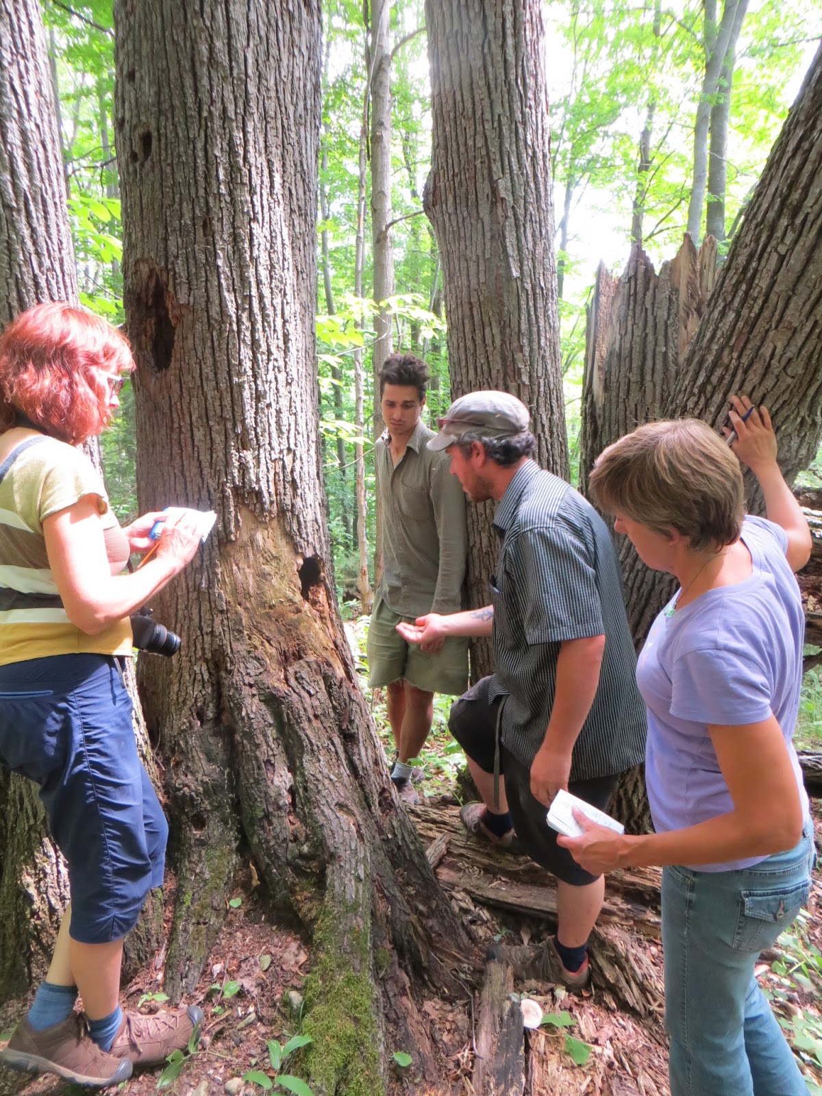
The site of a porcupine, raccoon and flying squirrel holes in this big old Basswood tree


Saturday and Sunday, July 26th, 2015
Written by Tamara Anderson - 2nd year Tracking Apprentice

In his book Nature Observation and Tracking, Tom Brown Jr. writes; “The earth tries to be flat.” He was referring to how weather and gravity “conspire to erase tracks”.  This past July, the tracking apprentices observed the subtle traces of summer tracks at Allan Park near Durham. We also created tracks and signs at Alexis’ house and watched how they changed over two days.  Lately, I have been tracking the landscape just as much as I have been following the footprints of animals.  Approximately 10,000 years ago, a receding glacier scraped the surface of the land that is now Allan Park and deposited material from the Canadian Shield.  Some of the material was ground into sand, silt and clay. A huge chunk of ice from the glacier dropped onto the landscape and a kettle lake was formed.  Allan Park is part of the Horseshoe Moraine. It includes a trail system that reaches an elevation of 30 metres in some places. 

Fawn Tracks
On Saturday, we wandered the rolling, forested pine, spruce and cedar hills beside the glacier-made trout pond.  The sandy edge of the pond revealed the opened shells of snapping turtle eggs.  This prompted a few questions:  How does temperature affect turtle egg incubation? Do predators leave different signs when they predate turtle nests?  I learned that the “J” shape of the Jack pine cone is a helpful way to remember the cone-makers identity.  Sue asked about whether any local species of rats are native to North America and which snakes have live birth?

Watching Tracks Age
On Sunday morning we were enchanted by the purling rattle of a Sandhill crane in a field near Alexis and Bobbi’s place.  Sandhill Cranes beckon my attention in an ancient way. After reading about Sandhill cranes, I discovered that they are the oldest known surviving North American bird species.  That morning, we returned to Allan Park and found a trail on a steep hill that led to different interpretations.  It is amazing how the track of a sliding deer can look similar to the five toes of a barefoot, feral child;)  After following a doe and her fawn’s tracks along a sun-baked, sandy trail, we ventured into a cool, deciduous forest of Hickory, Basswood and Maple.  The tracking apprentices used tracking sticks to track each other in leafy debris.  Luke and Miriam discovered a vole tunnel and burrow network at the forest edge.  We lightheartedly discussed how best to classify this trail.  If vole trails under the snow are called “subnivean” then would this trail under the leaf-litter be called sub-humusean?  We also wondered whether the trail was from a red-backed or a meadow vole.  Do meadow voles occasionally lives in forests?  What is the range of the red-backed vole? Alexis located a flying squirrel latrine in a basswood tree. Flying squirrel scat accumulates in areas where the squirrels nest and cache food. The scat often flows out of tree cavities, low to the ground. 

I will end this post with a continuation of Tom Brown’s tracker wisdom; “There is hardly a square foot of ground that is absolutely flat. Every depression, every bump, every fissure, and every scratch on the landscape was made by something. Whether it was made by a rabbit, mouse, bulldozer, fish, frog, or volcano, it is the tracker’s job to notice and interpret it.” (Tom Brown Jr., Nature Observation and Tracking)

Thursday, July 2, 2015

Tracking in the Sauble Beach Area


Saturday, June 13th, 2015 - Story of the Day

Congregating at Alexis’s place before starting our drive to Sauble, we travellers arrived with stories of our adventures.  Sue, Aster and Luke had stopped to investigate some road kill, get hair samples and pull the bodies to a more peaceful resting place. Miriam shared her experience watching the fireflies come out the night before and was grateful for the peaceful misty morning drive. Following a quick tour of the beautiful place we’d call home for the weekend, we set out.
Arriving at our destination we headed to the sandy areas to look for tracks.  We passed some yellow lady slippers that grew just off the path – a cheery welcome. A chance meeting with a grandfather and his grandson concerned about the debris being dumped in the area made us mindful of how important stewardship is to our interaction with this land.
How rewarding it is to find an animal at the end of the track you are following…and so it was with one of our first finds….a millipede (North American maybe?) A close look afforded a view of the tiny leg tracks. Close by was a curious raised line that when uncovered exposed a wee round tunnel a mere 1/8th of an inch in diameter.  Clearly the makings of a creature much smaller than the millipede.

Off at the edge of the wooded area Luke and Sue located what they suspected might be lagomorph signs. Investigating further we discovered more clues including prints, a small enchanting opening into the cedars we crouched to look through, and some intriguing scat. Lagomorphs are “coprophagous” which means they eat their first scat to glean nutrients from the undigested material contained therein. By comparing two scat samples we think we might have found some uneaten first scats. Is there a story behind this? Might the nearby fox scat, though older, be a clue?
Back onto the sand we found more lagomorph tracks. Cottontail or  Snowshoe Hare? Careful measurement of trail width, track size and stride length helped us to place our bets on cottontail. Drawn by the activity of the egrets and crows in the distance we set off to see what we might find of bird tracks, and of course anything else of interest…bear tracks were on all of our wish lists.
Lunch at the point was a lovely time of spectacular views, ideal weather (Alexis wished he’d brought his bathing suit), and happy companionship. After lunch Luke went to look for frogs, Miriam and Aster investigated the area barefooted in the cool water, and Sue and Alexis went looking for the nest of the killdeer we’d sighted. Though the nest was never located, when we all joined up again to move inland we suspected we must have come pretty close to the nest because the killdeer performed its characteristic broken wing diversion trick. A female redstart sighting led us on a journey into the woods in search of more bird sightings…male redstarts? and if we were lucky maybe a redstart nest. Alexis drew our attention to a tree rising proud above its neighbours, spreading its almost leaf-bare arm-like branches out to the side. An attractive perch for large birds? Binoculars allowed us to see the worn bark in places and confirmed our suspicions. The base of the tree beckoned…what treasures might be found? Luke found a skull that remained a mystery even after consulting the skull book later on. Lots of white wash. A green feather! Heading back came across a few egg shells – of a similar mottled colouring but of a much smaller bird than the killdeer eggshell we found earlier.
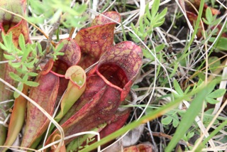
Out in the open again we encountered clusters of pitcher plants. Like all carnivorous plants, pitcher plants grow in locations where the soil is too poor in minerals, especially nitrogen and phosphorous, and/or too acidic for most plants to survive. The digested insects, and sometimes larger creatures like mice and frogs! provide the pitcher plants their needed mineral nutrition. More bird prints. Having encountered a number of prints throughout our journey we were able to compare and contrast our findings and use these comparisons and our resource guides to help us distinguish, in particular, sandhill crane and great egret tracks. Noting the toe positioning was helpful identifying some smaller prints as likely corvid tracks. What a treat to then come across some turtle tracks! A fun experience trying to identify them…the penny dropped for all of us when Alexis gave us the hint that he didn’t think they were mammal tracks.  The drag marks and ambling gait finally made sense if it was a turtle!  While inspecting the turtle track we encountered tiny frog and vole tracks too. What day filled with richness.  From the tiny millipede tracks to the grand wingspan of the great egret in flight passing overhead. From the close inspections of the finest details of our finds to the expansive vistas out over the land and water.

Back at Alexis’ place we enjoyed a potluck dinner of delicious food and story sharing. Under a starlit sky we ended the day spending time together around the campfire before heading to sleep to the sound of the night creatures.


Written by Miriam Snell - 1st year Tracking Apprentice

Tracking on the Sauble River


Sunday June 14th, 2015 - Story of the Day
 Written by Tamara Anderson


Bob Marley wrote, “Some people feel the rain and others just get wet.”  The rain reminds us of mindfulness - to live in the moment and welcome whatever it brings.  We were immersed in rain and mindfulness for most of Sunday’s outing to the Sauble River.  The Sauble River flows through Bruce and Grey County into Lake Huron.  The river was named “Rivière aux Saubles” or Sandy River by the French explorers in 1759.  I wonder if the local Saugeen First Nation has a different name for this river?

The maple forest revealed a few gems, like a brave garter snake.  The snake patiently let us hold him/her.  Beaver, coyote, raccoon and muskrat tracks were also spotted along the silty shoreline of the river.  Nearby, Alexis found an otter latrine site with a freshly killed garter snake.  Had the garter snake fallen out of the grasping talons of a bird of prey?  The otter scat contained scales from fish and the rusty-coloured remains of crayfish.  A Red-Eyed Vireo serenaded us once again while we ate lunch beside the river.  After lunch, we found Giant Hogweed, an invasive plant whose sap can cause intense blistering and even blindness.  Strangely enough, we noted deer browse on the tips of the Hogweed. Deer never cease to amaze me with their ability to eat noxious plants.  My impression of them as adrenaline-seeking risk takers continues to evolve. 


We were soon on a quest for Kingfisher holes after seeing a steep, sandy river bank on the south shoreline.  Success!  A square-looking hole was found near the top of the bluff.      The Belted Kingfisher excavates a nesting burrow that is two to three metres long in a vertical sand bank.  The blue and white lightning bird digs the tunnel with its beak and feet.  We wandered south towards a colourful, alvar-looking landscape.  Sandy trails revealed coyote scat and mystery tracks.   We debated the track-maker’s identity and finally resolved to call the animal a fox-walking raccoon.  A short drive to Sauble beach on Lake Huron completed the day.  In our closing circle, each person shared their focal species for the next 8 months.  Aster chose the beaver.  Sue is learning more about deer.  Miriam is also studying deer.  Luke is thinking about lagomorphs.  Alexis is going to learn more about the European hare.  I am choosing to focus on the black coyotes that live around my place.  Strangely, no one chose the fox-walking raccoon?

Wednesday, June 10, 2015

Sign Tracking and an Intro to Wildlife Tracking


Written by Tamara Anderson
Sunday, May 24, 2015
Lockyer Pits, Orangeville

It was sunny and 26°C at the Lockyer Pits in Orangeville.  We began the day by tracking the weather. Wispy cirrus clouds moved across the sky.  Alexis shared his knowledge that cirrus clouds forecast a change in the weather within about 24 hours.  The first set of tracks that we found belonged to a raccoon.  We noted the placement of the front foot beside the rear foot as the procyon lotor ambled south towards the nearby subdivision.  We discussed the various forms of locomotion used by terrestrial mammals; Plantigrade (walking with toes flat on the ground like humans and raccoons), Digitigrade(walking on the toes or digits like dogs and cats), Unguligrade (walking on the nails of the toes (or hoof) like deer).
Next, we observed crow tracks.  We discussed bird foot morphology and how the most common arrangement for birds is anisodactyl, with three toes pointed forward and one backward. The toe that points back is called the hallux.  Ornithologists number the toes of each foot from 1 to 4. Toe 1 is the hallux and the other toes are numbered in sequence, beginning with the inside of the foot and circling out.*  Alexis shared a cool tracking tip for corvids (Crows, Ravens, Jays etc.). In Corvids, toe 2 and 3 are close together. In comparison, toe 3 and 4 are close together for members of the Blackbird family (Cowbirds, Grackles, Blackbirds etc.).
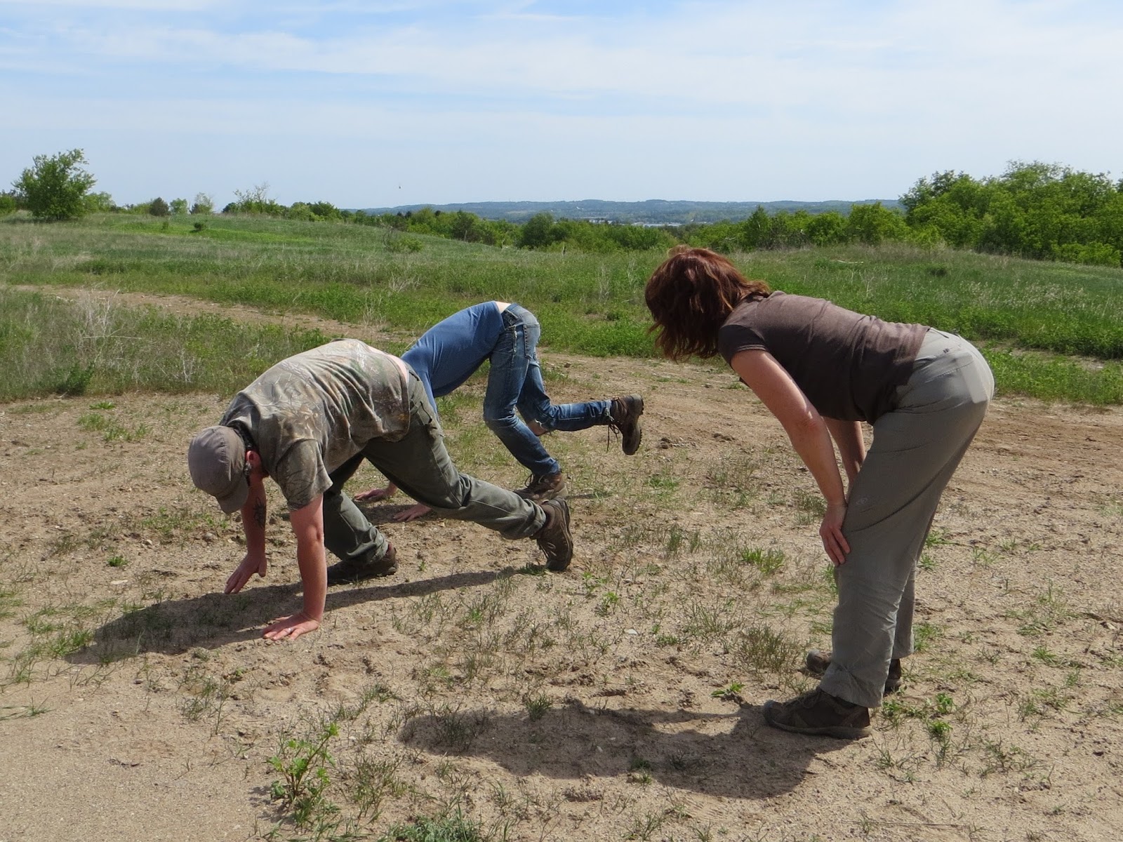
After observing some mystery scat which we later decided was most likely fox, Sue was curious about how to identify different fur-bearing rodents from scat contents.  Do rodents come in different colours? Are certain rodents more delicious than others?  Alexis suggested looking up shrews and voles in Peterson’s Guide to Mammals.  Much of the morning was spent measuring tracks and stride lengths for wild turkey, white-tailed deer, coyote, and skunk.  Aster, Sue and Alexis practiced diagonal walking and moving like the animals that we were tracking.  Aster and Sue were interested in the differences between domestic dog and coyote tracks.  Alexis shared that dog tracks are more splayed than coyote tracks due to a difference in physical fitness.  Dog tracks tend to wander whereas coyote tracks tend to have a straighter trail.  Dogs have kibble waiting for them at the end of the day.  Coyotes do not. 
The sandy, sun-baked, four-runner trails began to feel like a desert.  We ventured down towards the river and found reprieve and lunch in the shade of a cedar forest.  En route, we noticed an ant attempting to carry away a butterfly that was not quite dead yet.  Can ants use their formic acid to predate other insects? 
The afternoon was spent exploring sand pits, locating tracks and comparing the characteristics of coyote and fox tracks.  The question of which would be more valuable, gold or water in a desert came to mind as the contents of my water bottle dwindled in the hot sun.  We began to wonder if Alexis might soon demonstrate one of his revered survival skills and magically find us some water.  Alternatively, I pondered whether I might be able to devine where water was by picking up two sticks in front of me. Aster wondered if there might be water beneath the sandy ground where we could see dogwood growing.  Is dogwood an indicator species for water?  Solitary bees flew into sand tunnels all around us. One 6 mm tunnel had plant debris glued together in a silky turret at the entrance.  I later learned that this tunnel was likely made by a burrowing wolf spider.
One solitary bee made a burrow in a deer track.  What are the bees doing in the burrows?  Are they laying eggs?


Tamara kept a bird list for the day: Red-Eyed Vireo, Savannah Sparrow, Meadowlark, Great Crested Flycatcher, Chickadee, Grasshopper Sparrow, Song Sparrow, Northern Flicker, Northern Cardinal, Red-Winged Blackbirds, American Crows, Red-Tailed Hawk, Rose-Breasted Grosbeak, Blue Jay, Tree Swallow, Cliff Swallow.
It was great to be out tracking in the sandy trails of Lockyer Pits.  Next time, I will remember to bring more waterJ

Written by: Tamara Anderson - 2nd year Tracking Apprentice


*Elbroch, M. & Marks, E. 2001, Bird Tracks and Sign, Stackpole Books, Mechanicsburg, PA.

Spring Time Tracking at Mono Cliffs

Saturday, May 23, 2015 - Day 1

Mono Cliffs Provincial Park

Our group gathered into a circle under the shade of an old Sugar Maple at the edge of an open sunny field. We shared our goals, intentions and gratitude as we watched the wind blowing through the landscape, passing over the tall grasses and through the aspen/poplar leaves in a playful fashion. We watched a couple of Northern Harriers fly over the field, triggering a discussion on sexual dimorphism and hawk ID features, followed later by a Wild Turkey hen cautiously wandering out from her nest to feed.

After our sharing, we got up to prepare to head out into the field for our first day of tracking but right beside where we had been sitting, we noticed some really neat tent caterpillar webs on some young cherry trees! What type of cherry where they; black, choke or pin? We spoke a bit on how to tell cherry species from the shape, size and spacing of their flower clusters.

As we headed into the field, we looked back to our shady spot and saw just how much our own impressions on the land (where we had sat) resembled deer beds.
We didn't get more than 15 or 20 meters into the field before we stopped to look at some of our first animal sign. Alexis crouched down and pushed some grass aside, revealing a tiny trail carved into the ground underneath the tall grasses. He showed us a tiny piece of grass stalk cut on a 45 degree angle, indicating vole feeding sign. We spent the next while unveiling the intricate network of vole trails through the field. We wondered how large the territory range was for these tiny creatures, which according to Mark Elbroch, is 1/10 to 1 acre!
We saw plenty of large holes scattered over the field around some of the vole holes going down into the ground. Had someone like a fox or coyote been digging here to feed on the voles?

We stopped around a rock cropping looking for signs of weasel activity and talked about defining features of various local members of the weasel family.

Then we pushed towards the edge of the field along the tree line where we found some huge scars on the younger aspens from past deer antler rubbing. We stepped into the wooded area and began to travel along a deer trail that ran South, just a few feet into the forest. We took a look at some of the claw and teeth marks on various trees. Showing signs of porcupine and raccoons who had climbed these trees in the past.

We soon came to a spot where we noticed someone had been eating the trout lily greens. Who was the culprit, turkey, deer, rabbit? We took note that the greens were cut flat and sometimes slightly frayed. Then we found another clue, a hair that kinks when it is bent, indicating the eater's hair had a hollow core. A clear track then confirmed our suspicions.  White-Tail Deer.

We found some holes carved out of dead wood, triggering a lesson on how to differentiate between local woodpecker species from the signs. We were really able to bring home this lesson as theory was confirmed as we found examples in the field of signs from nearly each type of woodpecker throughout the course of the day!
In the afternoon, we made our way along some beautiful cliff ridges carved out around 11 000 years ago by some great glacier melts, providing breathtaking views of the valley below. We sat watching and listening to the birds together,  sighting some rose-breasted grosbeaks, red-eyed vireos, chickadees, turkey vultures, ravens and a few different warblers. We split up for some grounding sit-spot time long the cliffs before embarking on the descent back down towards our meeting point.

Throughout the remainder of the day, we wandered through the woods, talking about trees and plant ID, deer rutting behaviour, predators of ant hills, grouse vs wild turkey dust baths, what the deer have been eating and how to assess the age of forests based on the plants and trees growing there. It was truly a day full of many lessons, tying academic information in beautifully with experiential learning in the field.


Written by:  Lianna Vargas - 2nd year Tracking Apprentice


Friday, April 10, 2015

Landscape Tracking - Learning from the Land

This weekend’s theme was landscape tracking! We met at the Hockley Valley Nature Reserve near Orangeville. Few of us had been to the area, so we were keen to go exploring.
After a quick gratitude circle, we followed the trail west for a few minutes, then out into a grassy lowland next to a treed slope. All the grass had been pushed down and there were trails cutting through. Was it the work of deer? Was it people? Or had someone’s enthusiastic dog rolled all over? Jeff noted that the goldenrod was still standing. Could that be a clue about the perpetrator? We bent down and looked at the green carpet more carefully. It was green on top, but brown underneath. This grass had been pushed down for quite a while.
Alexis decided that we should follow the deer trail up the slope and into the trees just to see where it would take us. By observing the trail, we could see how they shaped the landscape. The deer had worn a rut into the earth, and when we stepped off-trail, we sank into the soft pine needle carpet. Punky logs in the path of the deer had been pulverized by their hooves.
Were the deer going uphill or downhill? Was the trail only used to go one way or both? We tried to imagine when the deer would go down to water or up to higher ground and what would influence them to go in either direction. For example, hot air rises during the day and sinks at night. Where would they go to be able to smell a predator? Where would they go to stay cool?
The group spent some time walking in silence. Such a heavily used trail could yield a wild animal sighting if we were careful. Soon, our main trail branched off left, then right, then uphill and downhill. Before long, three separate groups were stalking along deer trails, trying to spot the animals that had made them.
The slope and the top of the ridge were full of red pines. Those had thinned out, their place taken by beeches, ironwoods, oaks, maples, aspens and birch. The understorey had changed, too. We were seeing leatherwood and forest goldenrod. What would attract the deer to this area? Most likely the acorns and beech nuts, especially in fall and winter.
Alexis called us over to investigate a depression in the hillside and asked, what happened here? There were several such depressions, usually close to trees. Some of us thought they were caused by erosion. Others thought they were burrows. But Victor guessed that they were created when a tree had fallen over long ago, its roots pulling up all the surrounding dirt. It had happened so long ago that the trunk had disintegrated. He had guessed right, and we were shown where the signs of what happened could be found: the canopy. Surrounding the hummock were fast-growing aspens and birch, pioneer species that had grown up to take advantage of the sunlight that had been blocked by the big tree’s leaves before it had come down. If we could age those aspens, we might get an idea of when the tree fell – though a good guess would be 1954, the year of Hurricane Hazel.
Back to the deer trails: The main trail led out into another grassy field, so out we went to see where the deer had gone. The field was full of goldenrod, yarrow and asters, typical late summer forbs, and trails criss-crossed through the grass. Each of us tried to follow one, but it wasn’t clear where they were going or even if we were following deer anymore. We remembered an earlier lesson about what trails made by animals low to the ground look like when compared to trails made by animals with long legs. Maybe there were rabbits or raccoons in the area?
A few anthills dotted the field and before long, we were standing around one that had attracted Alexis’ attention. At over a foot wide and about 10” tall, it wasn’t the biggest one we had seen, but it wasn’t the size that warranted investigation; it was the accumulation of tiny, tubular scats on top. We were looking at a vole latrine. Why did the vole latrine here? Wouldn’t the ants bite the vole? Do voles eat ants, or are they strict vegetarians? We had lots of questions, and a flash of insight into small-scale landscape tracking.
Once we reached the other side of the field, we entered a lowland area of cedars bisected by a tributary. As we sat and had lunch, we discussed how deforestation in the upland areas had led to erosion, which meant silt running into the river. A siltier, shallower river in turn led to increased flooding and fewer salmon spawning, and that may have impacted an important food source for mammals in the area -- and a potential source of nitrogen for the plants and trees. They say our forestry practices have changed a great deal over the last decades. I wonder how.
Now that we were in the mindset of cause-and-effect, we were asked to go quietly out around the area and sit and observe. “What happened here?” was the question we were to ask ourselves over and over again as we looked at the landscape, the flora and the fauna. At the end of our exercise, we came together again and shared some of our key observations. Steve, a second-year tracking apprentice, said that he was looking at the water and thinking about how fallen trees might have changed the river’s path. Did some of the little islands have tree trunk foundations?

It was time to get moving. We climbed up gradually then climbed down very quickly into a valley carved by a creek long, long ago. As we climbed back up the other side, we stopped to marvel at a beautiful, fiery-orange salamander. Not long afterwards, we found another vireo’s nest at almost the same height we had found the first one in July. Alexis said he liked seeing so much bloodroot in one place. You don’t often see so much at one time.
In no time, it seemed we had returned to a well-worn deer trail like the one we had found at the beginning of our day. We walked in a line all the way back to the trail head. Mark said he could tell we were close to the meadow where we began because he could hear the crickets chirping. After another quick closing circle, we were done for the day.
What eye-opening lessons! Who knew that the anthill to the vole is as important as the ridge is to the deer? If you’re interested in learning more, here are a few books you might be interested in:
Reading the Forested Landscape by Tom Wessels

The Peterson Field Guide to Eastern Forests, by John C. Kricher

Written By: Christina Yu - 2nd Year Tracking Apprentice